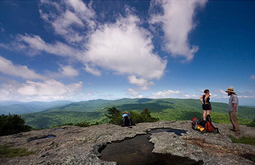
The USDA Forest Service has closed the parking lot and associated trail that provides access to Spy Rock. The Forest Service is closing the parking lot located behind the Montebello Fish Hatchery in Nelson County.
The public can continue to access Spy Rock via an alternative route. Hikers should be aware that this alternative route is approximately 6.5 miles in length (round-trip) and has fewer trail blazes and other directional signage. All hikers should carry a map of this alternative route and be well-prepared for this longer distance hike.
Parking for this alternative route is located at the end of State Route 826 (Meadows Lane). State Route 826 is maintained by the Virginia Department of Transportation and is not suitable for some passenger vehicles. The road is recommended for travel only by higher clearance, four-wheel drive vehicles.
Access to the trail requires a minimum 6.5-mile round-trip hike which includes a steady uphill grade, sections of very steep trail and rocky terrain and sections of gravel road.
Directions
- From State Route 56, take State Route 826 (Meadows Lane) for approximately 3.75 miles to its end point at the Crabtree Meadows parking area.
- From the Crabtree Meadows parking area, hike back along State Route 826 for 0.5 miles and turn left onto Forest Service Road 596 (Cash Hollow Road).
- Hike* along Forest Service Road 596 (Cash Hollow Road) for 0.5 miles to the intersection with the Appalachian Trail.
- Turn right (south) on the Appalachian Trail and continue for 2.1 miles to the intersection with Spy Rock Trail, Forest Trail #732.
- LINK TO MAP
*Note: No parking is allowed on or along Forest Service Road 596 (Cash Hollow Road).
For more information on Spy Rock, please contact the Glenwood and Pedlar Ranger District office at 540-291-2188.


